Services
* Aerial Photography.
* Digital Triangulation.
* Photogrammetric Data Capture.
* Ortho-Imagery.
* LiDAR
Aerial Photography
Using Leica DMC digital metric aerial cameras with gyro-stabilized mounting. Projects are flown during cloud-free conditions when streams and creeks are within their banks and the ground is free of snow.
Triangulation
Method to produce supplemental ground points and to verify the accuracy of the ground control provided. This entire process is accomplished in a digital environment using Hexagon ImageStation software.
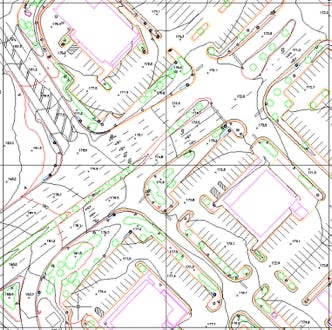
Photogrammetric Data Capture
Data capture is performed using Cardinal Systems VR Two photogrammetric workstations. All features to be captured are digitized into specified layers, symbolized and color-coded as a quality control measure. A digital terrain model is constructed and contours are interpolated at the desired interval.
Ortho-Imagery
Cardinal Systems VROrtho is used for ortho production. This includes rectification, tone balancing, mosaicking, and quality assessment. Uneven lighting conditions are balanced to enhance the detail in the image. Mosaic lines are defined individually then tone matched during the mosaic process to provide consistent image quality output over the entire project area.
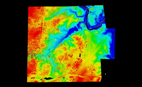
LiDAR
Point clouds in the millions with a vertical accuracy of 5 cm allow data collection in wooded areas with the leaves on. We will thin the cloud to a manageable level and integrate strategic photogrammetric data ensuring a dataset to meet your needs.